Mountain 'Drew'
Course Developer: Connie Scanlan
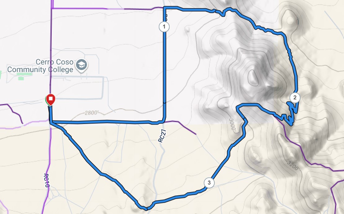
The name of the course comes from the fact that it basically goes around Andrew Peak and back. It is about 4 miles, has a little under 700 feet of elevation gain, and will be marked with bright red-orange ribbon. It starts and finishes at the white "ATTENTION" sign on the west side of the college fence across from the College Trailhead dirt parking lot.
Course Description
At the "ATTENTION" sign, begin on the trail along the fence heading south. Turn left at the corner of the fence to head west down the dirt road behind the college. At the southeast corner of the fence, turn left again to head north on RC27 toward Sunland trailhead.
At the northeast corner of the fence, turn right to head east through the Sunland trailhead parking area and continue on the trail up to the saddle. At the saddle, veer right on a single track to go downhill about 0.1 miles, then follow markings to go right at the split.
Continue down to where the trail merges with the main trail and head right (south). Continue about .15 miles southeast up to a trailside bench, where you will stay to the right to take the trail heading south for about 0.3 miles. Follow the markers to drop down to cross the road/wash and make a short climb to join the switchbacks.
Continue up the switchbacks for about 0.4 miles to get up on the ridge. Follow the ridge northwest briefly to pass another bench, then take a left to follow the jeep road downhill for about 0.3 miles.
Follow markings to head southwest/west for about 0.5 miles, where you will hop over a hill and continue northwest back toward the southwest corner of the college fence (about another 0.6 miles). Take the trail along the fence again back to the start/finish.
The green buttons will take you to a Course page on Garmin Connect, or a Route on Strava. If you need a .gpx file, you will be able to download that from either of these route pages. You can review the route navigation instructions here.